
Finding Costa Mesa Neighbors
Finding Costa Mesa neighbors starts with one address and a clear question. The Orange County GIS parcel map can show the target lot, adjoining polygons, and APNs. The Orange County Assessor can add an owner or assessee lead, a situs address, and a mailing address. Costa Mesa permit files can add a project or construction trail. A historical reverse directory can add an older subscriber or occupant. Voter data can support block analysis only after a permitted request. These sources do not make one complete roster, so the table pairs each source with its access path and limit.
| Source | Block evidence | Access path |
|---|---|---|
| OC GIS parcel map | Parcel shapes, APNs, adjoining lots, and selected layers around a target address. | Free map browse and click. |
| OC Assessor parcel search | Owner or assessee lead, situs, mailing address, values, and legal-description cues. | Free address or APN lookup; unrestricted owner-name mode is not confirmed. |
| Costa Mesa Document Search | Permit and project chronology by address or project number. | Search first; use the CPRA form when needed. |
| Authorized voter file | Registration records by residence or precinct for a permitted purpose. | Application, fee, security, and use rules apply. |
| Historical reverse directories | Listed occupants or subscribers in address order for the years held. | Library or archive volumes; the local run is not fully verified. |
| Neighborhood programs and associations | Public organization names, channels, or meeting information. | Voluntary programs; no implied member roster. |
An owner name is not a count of people around Costa Mesa. A parcel roll cannot stand in for the whole block. A mailing address away from the parcel may suggest an owner elsewhere, while a matching mailing and situs address supports only an owner-occupancy clue. People without title, other household members, and protected residents may not appear. Start with the question, then choose the source that can answer it.
Mapping a Costa Mesa Neighbor Block
For a Costa Mesa block, the most auditable path is to move from the map to the record, not from a name to a guess. Enter a known address or APN in the Orange County Land Information System, pan or zoom until parcel outlines and street numbers are legible, and treat each selected polygon as a separate record. Read the immediate block by adjoining edges and lots across the street. A radius or buffer is not needed for that first pass, and browser scripting may be required.
- Search the target Costa Mesa address or APN, enable parcel boundaries, and record the target polygon’s APN.
- Click each parcel that shares an edge with the target, then the lots immediately across the street, and save every APN.
- Open each parcel in the Assessor system and record situs, owner or assessee name, mailing address, legal-description cues, and the displayed assessment fields.
- Use the APN, legal description, or tract and lot as the bridge to another record set. If the question becomes a whole named street, continue with the Costa Mesa street directory workflow.
Do not read an APN as a person. It is a parcel key that links the map, assessor, and recorded-document trail. A pop-up can hide the next polygon, so close it and click again. A narrow, address-led search is more useful than a broad pull because the Costa Mesa parcel service has a 2,000-record query limit.
Costa Mesa Neighbor GIS Records
The Costa Mesa parcel feature service has a published schema that reaches beyond a simple pin on a map. It can expose an APN and link, complete situs, owner-name components, spouse or second-owner fields, mailing fields, voting district, sale and prior-sale prices and dates, document number, deed type, lender or mortgage fields, seller, building characteristics, assessment values, old APN, subdivision, and legal block, lot, and book-page cues. That breadth makes the city layer a useful bridge from a block map to a recorder reference, but it still does not turn a title field into a household list.
- Parcel identity
- APN or link, complete situs, old APN, subdivision, and legal block, lot, or book-page cues.
- Names and mailing
- Owner name components, spouse or second-owner fields, seller, and mailing fields.
- Transfer trail
- Sale and prior-sale prices and dates, document number, deed type, lender, and mortgage fields.
- Property context
- Voting district, building characteristics, assessment values, and related map context.
Use these fields in roles. The situs locates the parcel. The mailing field tells where notices go. Sale and prior-sale fields point toward a transfer trail. Legal block and lot or an old APN can help bridge a changed street label. Verify current field names and identify controls in the live Costa Mesa map before relying on a layer label.
Costa Mesa Neighbor Voter Rules
California voter data has a different role in a Costa Mesa neighbors search. The Orange County voter self-lookup asks for first and last name, date of birth, and an additional identity field such as the last digits of a driver license, California ID, or Social Security number. It is a personal verification path, not a browseable Costa Mesa neighbor directory. A failed self-check does not prove that someone moved or disappeared.
The captured Orange County voter form makes the distinction visible: the fields are built to match one voter, then return that person’s status and election information.
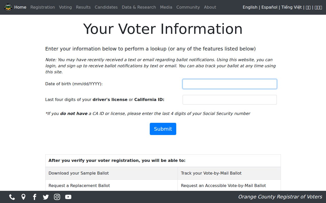
For Costa Mesa, that screen is a reminder that an individual can check a record without exposing a street roster.
An authorized file request is narrower in purpose and broader in analysis. California Elections Code §§2187 and 2194 and 2 CCR §19003 limit access to election, scholarly, journalistic, political, or approved governmental purposes, and commercial use is prohibited. A statewide file costs $100. Up to ten named voters may be requested with full name, date of birth, county, and address at $30 per named record, capped at $100. County requests are also possible and county fees vary. Such a file may be analyzed by residence or precinct for an approved purpose, but it must never be described as an open block list.
For Costa Mesa election questions, the Orange County Registrar of Voters lists 1300 S. Grand Ave., Building C, Santa Ana, California 92705, and 714-567-7600. Check the current counter hours before visiting.
Costa Mesa Neighbor Contacts
Costa Mesa’s public neighborhood layer is about programs and contact channels, not a household roster. City neighborhood programs may point to public service areas or organization channels. A public HOA or association page can publish a contact, meeting notice, or join route, but those details do not open a member list. The research did not locate an authoritative citywide inventory of every Costa Mesa HOA or neighborhood association, so a missing page should not be treated as proof that a group or block has no organization.
| Community source | Public contact value | Directory status |
|---|---|---|
| Costa Mesa neighborhood programs | Program information and a public city contact path. | Voluntary civic activity; no public member directory. |
| Costa Mesa Neighborhood Watch | Public program contact, including neighborhoodwatch@costamesaca.gov and 714-754-4876. | Voluntary block-captain model; no public member directory. |
| Public HOA or association page | Published contact, meeting notice, service area, or join route when an organization provides one. | Private member directories are not public; no authoritative citywide inventory was located. |
| Costa Mesa Historical Society | Directories, phone books, maps, newspapers, yearbooks, and oral histories for historical block context. | Research collection, not a current neighborhood membership roster. |
Neighborhood Watch is voluntary. Residents organize, choose a block captain, and may share contact details inside the group. A city page or public association contact can help someone ask about a meeting or local project, but it cannot verify who lives at a given address. Keep public contact facts separate from private lists, gated portals, congregation rosters, or block-watch contact trees.
Costa Mesa Historical Neighbor Records
A present-day Costa Mesa block may have an older name. Costa Mesa incorporated on June 29, 1953, after earlier county records were made. Annexations added the Fairgrounds and Mesa del Mar in 1955, Orange Coast College later in 1955, west-of-Harbor land in 1956, and northern acreage in 1959. For older material, a parcel may first appear in Orange County records without a Costa Mesa municipal file. The legal description, tract, lot, and old APN are better continuity clues than a modern city label.
Historical reverse directories can add the people layer that a deed cannot. The Costa Mesa Historical Society holds directories and phone books, yearbooks, maps, newspapers, and oral histories, including more than 27,000 photographs and 1,000 books. Its 1978 oral-history project interviewed 45 residents, with complete interviews available by appointment. Use those collections for family or civic connections, while treating collection years and access as title-specific. A directory entry may reflect a subscriber or listed occupant, not every person in the home. That makes it useful for reconstructing a historical block, but not for counting current people.
Costa Mesa Neighbor Business Records
Business records can add an affiliation clue near a Costa Mesa block, but business search is affiliation only. The California Secretary of State bizfile Online search supports a name or file number and advanced filters for entity type, status, initial filing date, and Begins With. Results may show entity number, name, status, jurisdiction, dates, street or mailing addresses, agent information, and filing images. A business address is not a home address, and an agent or filing contact is not proof of property ownership or residence.
The successful bizfile search capture shows why it belongs beside, not inside, the parcel trail: it is an entity lookup screen, not a Costa Mesa block roster.
Use the entity number, filing date, and address as cross-check keys when a company name appears in a permit or public project record. Keep the result labeled as business affiliation.
Broad Secretary of State searches default to 500 results unless narrowed, while filing roles vary. The Secretary of State also notes that ownership, phone, email, and associated businesses are not generally all of record. For a Costa Mesa block question, a business filing can clarify a storefront or organization name, then stop. It should not fill gaps in household data.
Costa Mesa Owners Are Not All Neighbors
Parcel data is strongest for land identity, not people count. In Costa Mesa, owner occupancy is 39.6% for 2020-24. That figure explains why owner names cannot stand in for all neighbors, even when the map, owner mailing address, and situs line up. A parcel can have an entity, trust, second owner, or mailing address away from the lot. A household member may never appear in title or tax data. Use owner fields as a lead to the next record, never as a claim that a named person lives on the block.
Four terms keep Costa Mesa block notes clean.
- APN
- The assessor parcel number, a key that connects a map polygon to parcel records.
- Situs address
- The physical property label tied to the parcel.
- Owner mailing address
- The destination for assessment notices, which may differ from the situs.
- Owner occupancy
- An inference supported by matching fields, not a complete directory of people at the property.
Keep the parcel key, street label, and record date together. If an address changes, the legal block and lot, subdivision, old APN, or recorded legal description can tie the entries together. If a source gives only an owner name, save the source and date before comparing it with another Costa Mesa record.
Privacy Limits for Costa Mesa Neighbors
Some block facts are deliberately absent. Non-owner occupants, household members, utility customers, delivery recipients, and people using protected addresses do not form an open public roll. California Safe at Home supplies a substitute mailing address and mail forwarding for eligible survivors and other protected participants. Do not treat a missing or substitute address as evidence that a person is absent. Motor-vehicle address data is also restricted under federal and California privacy rules. Government Code §7928.205 limits unrestricted Internet posting of certain officials’ home address, phone, and name-plus-home-APN; Penal Code §146e addresses malicious disclosure of specified public-safety officials’ address or phone.
| Source type | What it can add | Why it needs care |
|---|---|---|
| Official parcel, assessor, permit, voter, and historical sources | Custodian-named fields, dates, parcel links, or documented public events | Each source has a defined purpose and may omit occupants or protected records |
| Commercial neighbor-tool category | Possible name or address lead compiled from mixed data | Refresh cycles are unclear; people can be omitted, misassigned, or merged |
When a Costa Mesa source stops at a privacy boundary, accept the boundary. Use a public organization contact for a neighborhood question, ask the relevant custodian about a lawful record request, or leave the gap unresolved. A careful block search does not turn a missing record into a claim about a person.
Lawful use. Costa Mesa records are for personal, lawful research, civic curiosity, family or neighborhood history, and safe contact. Do not use parcel, voter, business, or association information to stalk, harass, intimidate, impersonate, trespass, or harm anyone.